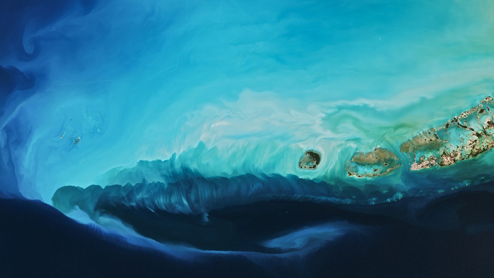
Sometimes the most compelling stories about our planet unfold not on the ground, but from high above. A striking satellite image recently captured a phenomenon that perfectly illustrates the raw power of extreme weather: a brilliant plume of swirling marine mud stretching across the waters off Florida's coast.
This visually arresting scene wasn't the result of a natural disaster or environmental catastrophe—rather, it was created by one of winter's most formidable forces: a blast of Arctic air from the polar vortex that swept across much of the United States. The image serves as a tangible reminder of how interconnected our atmospheric and oceanic systems truly are, and how events in the upper atmosphere can have visible consequences on Earth's surface.
**What Creates These Stunning Plumes?**
When extreme cold air masses move south from the Arctic, they don't just affect temperatures on land. These atmospheric changes interact with ocean waters in fascinating ways. In Florida's case, the cold blast whipped the typically calm coastal waters into action, stirring up sediment and marine mud from the seafloor. The result? A bright, swirling plume visible from space—a natural masterpiece painted by meteorological forces.
The brilliant white or light-colored appearance of the plume comes from the suspended sediment particles reflecting sunlight back into space. Satellites equipped with advanced imaging capabilities can detect these subtle changes in water coloration, allowing scientists and observers to witness phenomena that would be nearly impossible to see from ground level.
**Understanding the Polar Vortex**
The polar vortex that created these conditions brought severe winter weather to large portions of the United States. This isn't just about snow and cold temperatures—it represents a significant disruption of normal atmospheric patterns. When the polar vortex weakens and its cold air spills southward, it can affect weather across vast regions, sometimes reaching areas more accustomed to milder conditions.
For residents of Florida and the Southeast, such Arctic blasts are relatively rare, making their impacts all the more notable. The visible effects—like the remarkable plume captured in this satellite image—provide scientists with valuable data about how extreme weather events influence ocean dynamics and sediment transport.
**The Value of Earth Observation from Space**
Images like this one underscore the importance of satellite technology in understanding our planet. Without these orbital perspectives, we might never fully appreciate the scale and beauty of phenomena occurring in real-time across Earth's surface. Meteorologists, oceanographers, and climate scientists rely on such imagery to study weather patterns, track environmental changes, and predict future conditions.
The striking plume off Florida's coast is more than just a pretty picture—it's scientific evidence of how our atmosphere and oceans interact, how extreme weather patterns propagate, and how technology helps us witness the dynamic nature of our living planet from an entirely new vantage point.
No comments yet. Be the first!